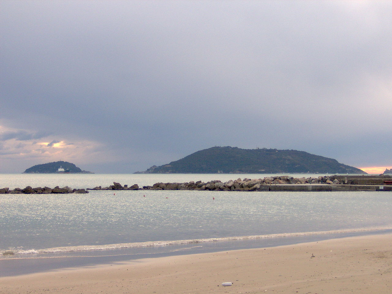
Portovenere's harbour front and church seen across the strait from Palmaria island
Portovenere · Island walk

The Palmaria Loop

Five minutes by boat from Portovenere's quay, the largest island in Liguria is a hump of pine, maquis and old marble quarries with a fort on the top and a beach at the back. Walk round it in three hours, swim at Pozzale, and come back to the best view of Portovenere there is.

About 7 km3 hoursModerateBoat a few euros
Photo via Wikimedia Commons
Home›Cinque Terre›Trails›Palmaria loop
Overview

The island across the strait

Palmaria, with its smaller sisters Tino and Tinetto, closes the Gulf of La Spezia to the west, and all three are part of the same World Heritage site as the Cinque Terre and Portovenere.

The side facing Portovenere is gentle, green and dotted with villas, bars and boat moorings. The side facing the open sea is a wall of cliffs and caves, including a Grotta Azzurra of its own, reachable by boat. In between, the island rises to a top of about 190 metres, crowned by a 19th-century fort built when the gulf became Italy's great naval base. For centuries Palmaria was quarried for portoro, a black marble with gold veins that ended up in churches and palaces across Europe; the abandoned quarries still scar its western flank.

The loop links the boat landing at Terrizzo, the summit, the beach at Pozzale on the southern shore and the coast path back past Torre Scola, a 17th-century tower standing in the sea. It is a varied, quiet walk, much less crowded than anything in the Cinque Terre, and you can swim halfway round.

The route

Round the island

Anticlockwise from the boat landing: up first, then down to the beach, then along the coast. Signposting is patchy; a map app helps at junctions.

2001000 m Terrizzo The fort Pozzale Torre Scola 0 km4.5 km7 km

Approximate profile.

  1. 0 km · Terrizzo

    Off the boat

    The shuttle from Portovenere lands at Terrizzo on the island's north-east shore, facing the town. Walk a little way along the waterfront past the bars and moorings, then turn uphill on the track signed for the island's summit.

  2. 1–2.5 km · The climb

    Through pine and maquis to the top

    A steady climb on tracks and paths through Aleppo pine, holm oak and myrtle, with ever-wider views back over Portovenere, the Gulf of La Spezia and the Apuan Alps beyond. Near the top stands the fort, a relic of the 19th-century naval defences of the gulf; parts of the summit area are fenced military or restricted land, so follow the marked path around.

  3. 2.5–4.5 km · The descent

    Down to Pozzale

    The path drops through the woods towards the island's southern shore, past views of Tino and its lighthouse, to Pozzale, a pebble beach in a cove looking out to the open sea. Swim, rest, and eat; there are seasonal facilities here in summer.

  4. 5–6 km · The quarries

    The marble coast

    From Pozzale the path follows the coast back north, past the old portoro quarries and the cliffs on the island's western side, where the black-and-gold marble was cut and lowered to boats for centuries.

  5. 7 km · Torre Scola and back

    The tower in the sea

    The last stretch runs along the shore opposite Portovenere, past Torre Scola, a pentagonal tower built by the Genoese in the 17th century on a rock just off the island, to Terrizzo and the boat. Or stop for lunch at Locanda Lorena, facing Portovenere across the strait.

Practical notes

Before you set out

Getting there

Portovenere is 30 minutes by bus from La Spezia station, or by hop-on boat from the Cinque Terre villages from late March to early November. Shuttle boats cross from Portovenere's quay to Palmaria about every half hour in season, for a few euros, and some continue to Pozzale.

When to go

  • Spring and autumn: ideal walking, quiet island.
  • Summer: start early and plan the swim at Pozzale for midday.
  • Check the last boat back to Portovenere.

What to bring

  • Shoes with grip
  • 1.5 litres of water
  • Swimsuit and towel
  • Cash for the boat
  • Offline map

Good to know

Parts of the island are military or private land and closed; stay on the marked paths. Paths can be overgrown in places. Boats round the island visit the sea caves and Tino, whose monastery of San Venerio opens only on its feast in September.

Before and after

Portovenere, the sixth village

Ideas from our Cinque Terre guide.

Palmaria · Lunch

Locanda Lorena

On the island · its own boat for diners

A fish restaurant with rooms facing Portovenere across the strait, which sends a boat for its diners. The lunch to plan the walk around.

€40–70 · $$$
Portovenere

San Pietro and Byron's grotto

On the rocky point

The striped Gothic church on the point where a temple of Venus stood, and the sea grotto below, where Byron is said to have swum off towards Lerici.

Portovenere in the guide →
Under the water

Tino and Tinetto walls

Portovenere dive centres

The islets' walls and the wrecks of the Gulf of La Spezia are the best dives near the Cinque Terre.

Diving →
More Cinque Terre walks

Where to walk next

Photography

Photo credits

Wikimedia Commons photographs are used under their Creative Commons licences; Pexels photographs under the Pexels licence. Click a title for the original, its author and licence.

Powered by Webloyt | Report abuse