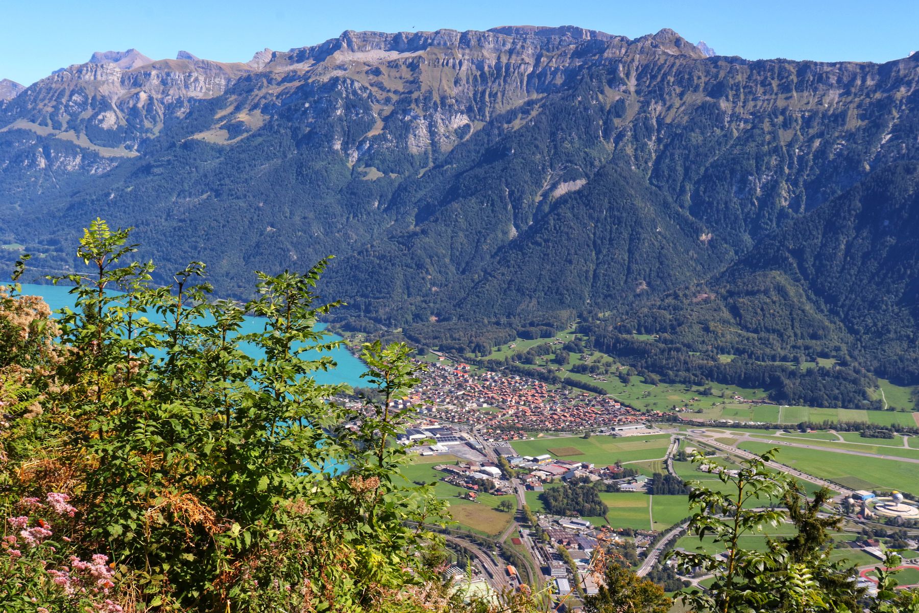
Interlaken's own mountain. Ten minutes by funicular to a terrace 750 metres above the town, with Lake Thun to one side, Lake Brienz to the other and the Eiger, Mönch and Jungfrau lined up in the gap between. Go up for sunset; walk down through the forest.
From down in town you can never quite see why Interlaken is where it is. From Harder Kulm you see it at once: a flat strip of land between two lakes, at the mouth of the valleys that lead to the high peaks.
A funicular, opened in 1908, climbs from its station by the Aare near Interlaken Ost to Harder Kulm at 1,322 metres, where a turreted restaurant from the same era sits on the ridge. Beside it the Two Lakes Bridge, a viewing platform cantilevered over the drop, looks down on both lakes and straight across to the Jungfrau massif.
Sunset is the moment: the lakes turn silver, then the snow on the Jungfrau goes pink. Ride up in the late afternoon, have a drink or dinner on the terrace, and either take the funicular down or walk the steep forest path back to town in the dusk. Doing it the other way round, walking up, is a stiff but rewarding 2 to 2.5 hours.
Signed "Interlaken" from the top station. Bring a head torch if you are walking down after sunset.
Approximate profile.
Walk out onto the Two Lakes Bridge for the view, then find the path signed for Interlaken just below the restaurant.
The path drops steeply in tight zigzags through beech and spruce, with roots and steps underfoot and occasional glimpses down to the lakes through the trees. Benches mark a few viewpoints. Ibex live on the Harder's crags and are sometimes seen near the top.
The path reaches the valley near the funicular's lower station, beside a small alpine wildlife park, and the bridge over the Aare to Interlaken Ost and the town centre.


The lower station is a few minutes' walk from Interlaken Ost, across the Aare. Trains run every 15 to 30 minutes in season, into the evening in summer; check the last departure if you are relying on it. Covered by the Jungfrau Travel Pass and Berner Oberland Pass.
The tandem paragliders that land on the Höhematte meadow in town launch from Beatenberg and other slopes nearby. Watching them circle over the lakes from Harder Kulm is part of the show.
More in the guide →_(7622570258).jpg?width=960)
The great ridge walk over the Faulhorn above Lake Brienz.

Flat along the valley floor past Staubbach and Trümmelbach.

Fifty minutes from the gondola to a mirror under the Faulhorn.

Männlichen to Kleine Scheidegg, with the Eiger growing ahead.

The turquoise lake under the Blüemlisalp, and the Heuberg view.

Under 1,800 metres of rock and ice, from Eigergletscher to Alpiglen.
Wikimedia Commons photographs are used under their Creative Commons licences; Pexels photographs under the Pexels licence.